Regional ecosystem mapping, checked
NUMBAT
On request
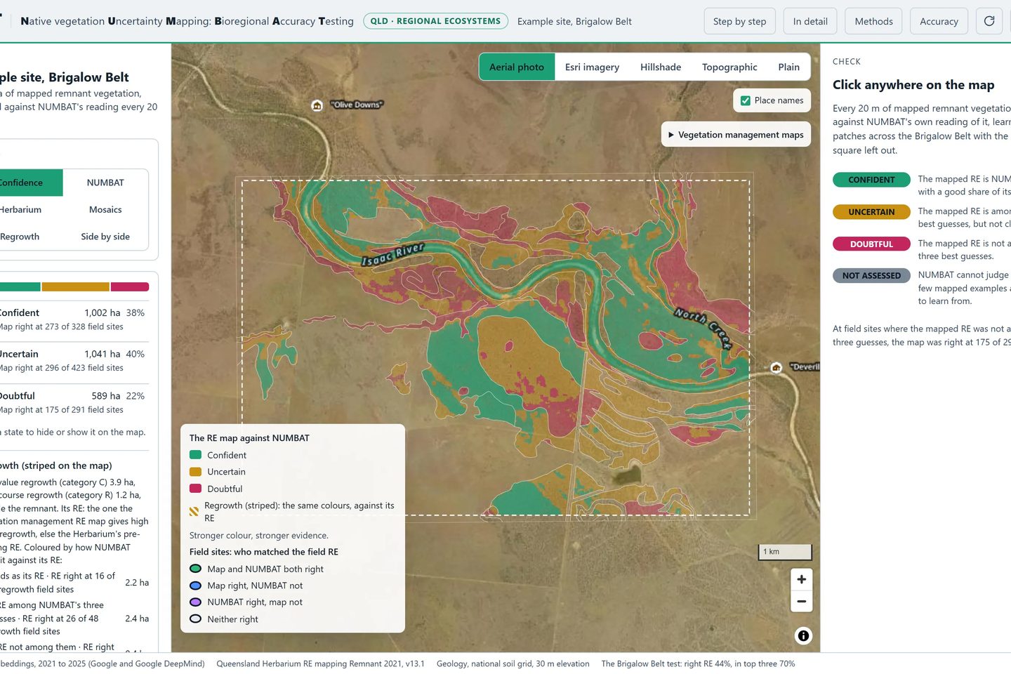
What NUMBAT does. Queensland's regional ecosystem map, drawn by the Queensland Herbarium, sorts the state's native vegetation into more than 1,400 types. Each type's class under the vegetation laws helps set the rules for clearing, development and offsets. Because the map is drawn at a regional scale, it can be wrong on a single property. NUMBAT (Native vegetation Uncertainty Mapping: Bioregional Accuracy Testing) makes its own reading of the vegetation type in every 20 m square. It then shows where its reading agrees with the map and where it doesn't.
How it works. It reads each spot from above, with satellite data recorded over several years, and from below, with the rock, soil, height and slope. It learns what each vegetation type looks like from thousands of patches where the map shows one clear type, and it is never shown the 5 km square it is tested on. Every spot then gets a traffic light:
- green where the mapped type is its best guess
- amber where the mapped type is among its three best guesses
- pink where it isn't
Its own guesses are shown beside the light. High value regrowth is read the same way, and its height and cover are set against the remnant of its type.
Why it's useful. Checking every hectare on foot is slow and expensive. For a site of up to 400 km², NUMBAT shows in minutes where the map is likely sound, where it is doubtful and what the likely alternatives are, so field time goes where it is most needed. It covers seven of Queensland's 13 bioregions so far and is being extended to the other six; it is tested against field sites from published ecological assessments in five of the seven. Other states will follow, each read against its own vegetation classification, such as the plant community types of New South Wales. It does not replace a field survey.
For ecological consultants, councils and state agencies, mapping teams and landholders who rely on Queensland's regional ecosystem mapping.