A walkthrough of the app, Queensland
GLIDER step by step
GLIDER, the Guide to Land-use Impacts, Development and Extinction Risk, shows for Queensland where woody vegetation has been cleared since 1988, what is there now, and the projected exposure of threatened taxa by 2070. This walkthrough goes through it from the first screen to the method, on real pages.
Play scrolls at a reading pace; a wheel, a tap or a key hands control back.
Queensland, 1988 to 2024
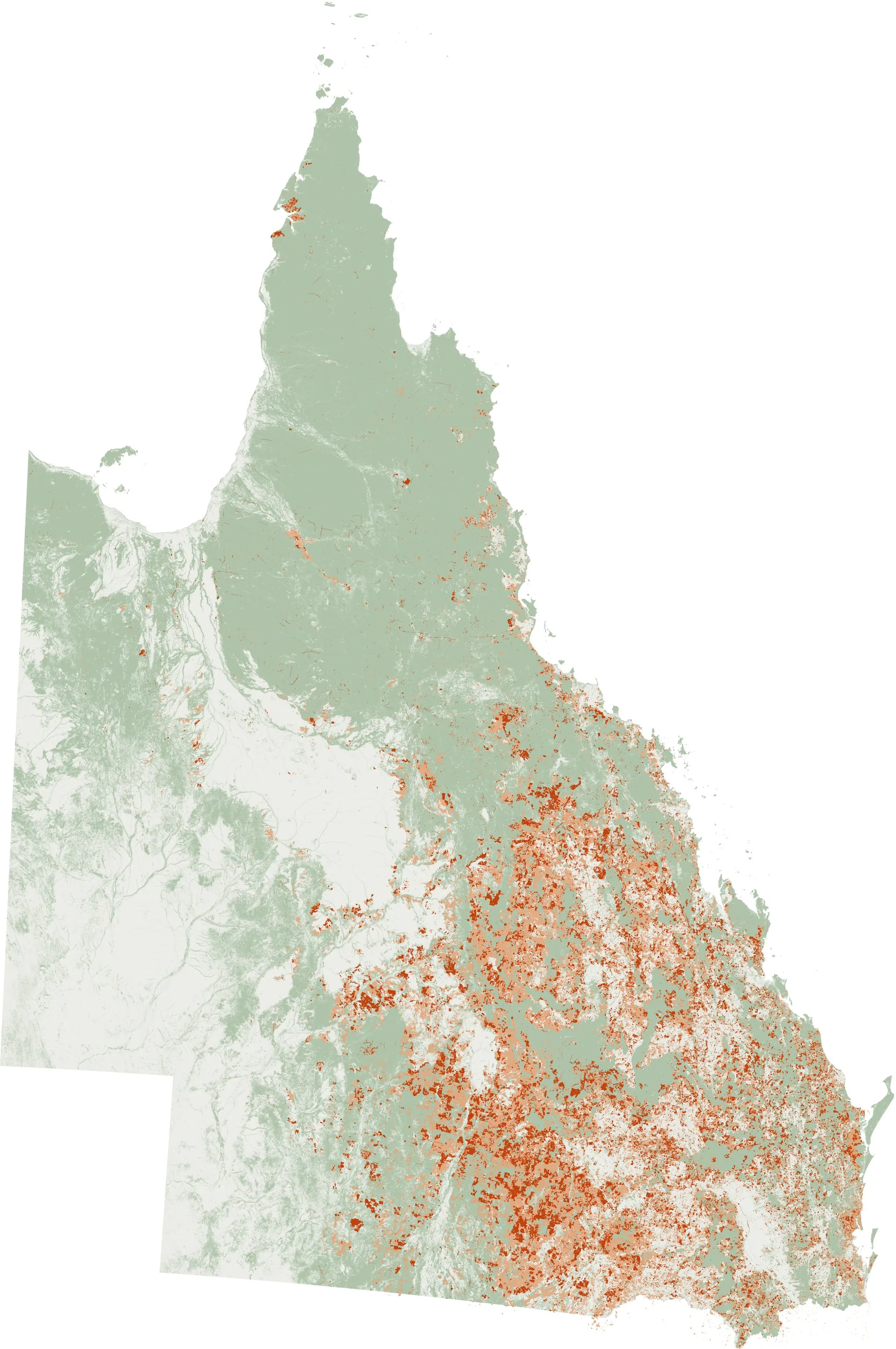
13.6 million hectares of woody vegetation cleared in the 29 SLATS periods, summed period by period: 8.9 M ha in the early Landsat periods to 2008-09, 2.4 M ha in the Landsat years 2009-10 to 2017-18, and 2.4 M ha in the Sentinel-2 years 2018-19 to 2023-24.
Woody vegetation, 2023
Cleared, 1988-91 to 2017-18
Cleared, 2018-19 to 2023-24
Queensland, October 2026
Protected land
Petroleum leases and pipeline licences
Mining leases, mining claims and petroleum facility licences
EPBC referral areas, approved since 2016 or under assessment
GLIDER's 100 m grid drawn at 800 m a pixel, with the clearing shades strengthened so that scattered clearing shows.