Constraint screening and assessment

SiteCensus

Beta

Draw the site, run the screen, download the written report. SiteCensus queries every live government layer that could reach your site in one run and writes the assessment, with the reasoning and the full record behind it.

Queensland and New South Wales are live, with more states to follow. No install and no GIS licence. Free for seven days, no card needed.

For environmental, planning and engineering teams who screen sites before design.
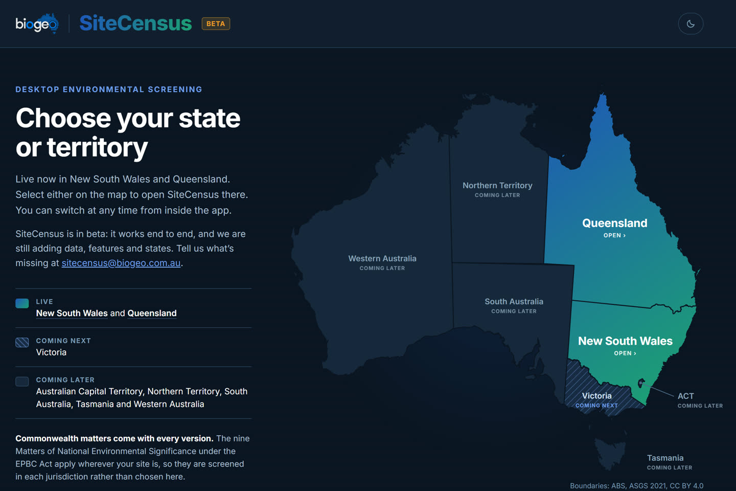
SiteCensus: choose your state or territory, with Queensland and New South Wales open

Questions asked of the public data

Discovery

Coming soon

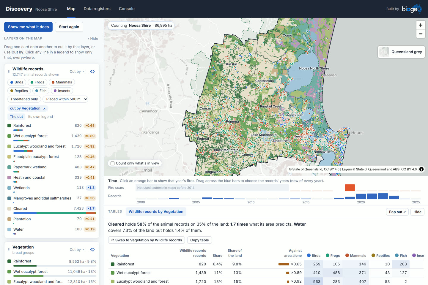
Drop one map layer on another and see how they relate, read as a table, a map and a chart of the same numbers. In this view, Noosa Shire's wildlife records are cut by vegetation, with each type's share of the records set against its share of the land.

In development. It will be listed here when it opens.

Discovery: Noosa Shire wildlife records cut by vegetation, with a time strip and the table of results

National environmental data discovery

Baseline

Coming soon

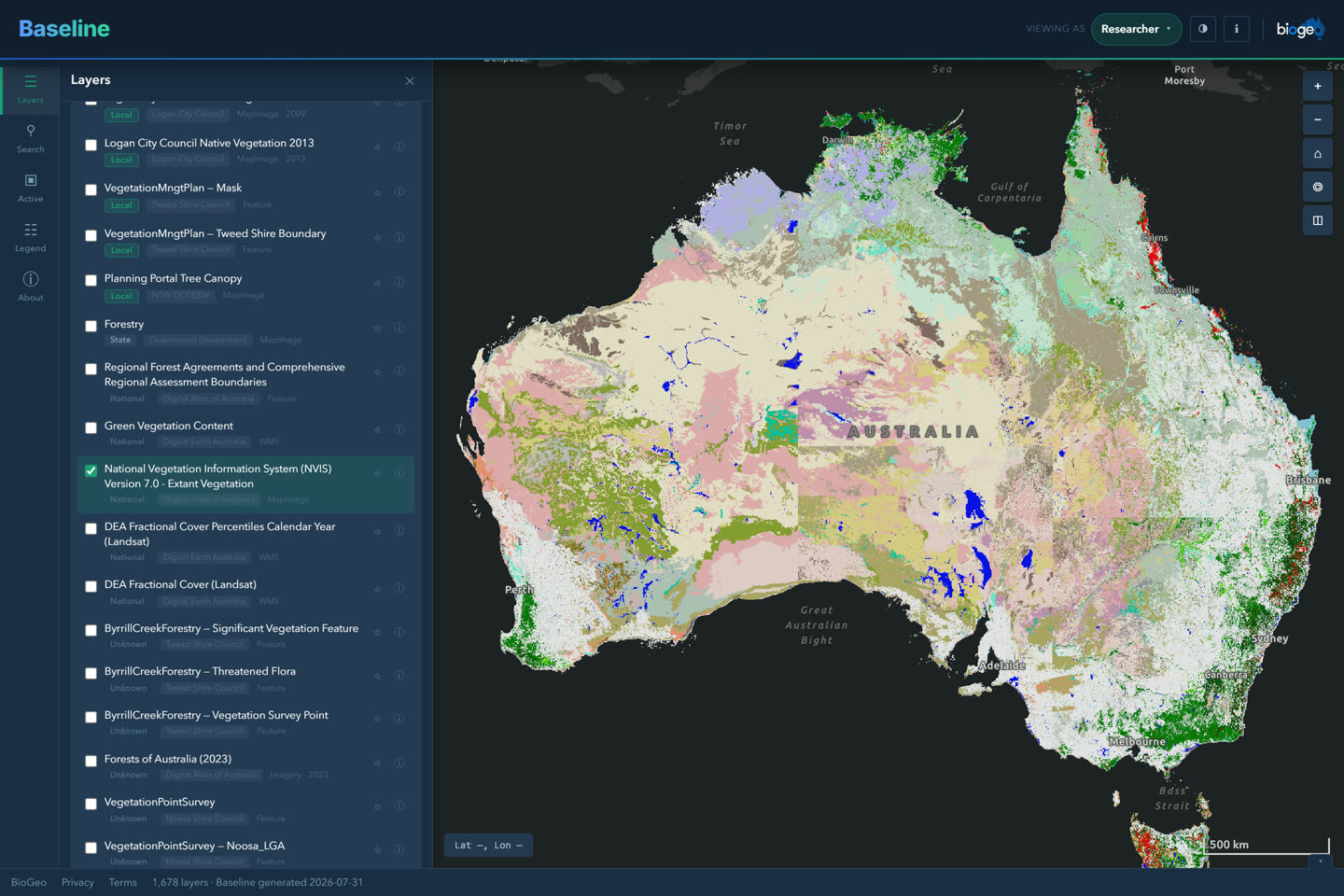
Free and national: Australia's public environmental data, from councils to the Commonwealth, in one catalogue of more than 1,600 layers. Find a dataset, filter it and put it on the map.

In development. It will be listed here when it opens.

Baseline in dark mode: the national vegetation layer on the map beside the layer catalogue

Read any map layer

Layer Lens

Coming soon

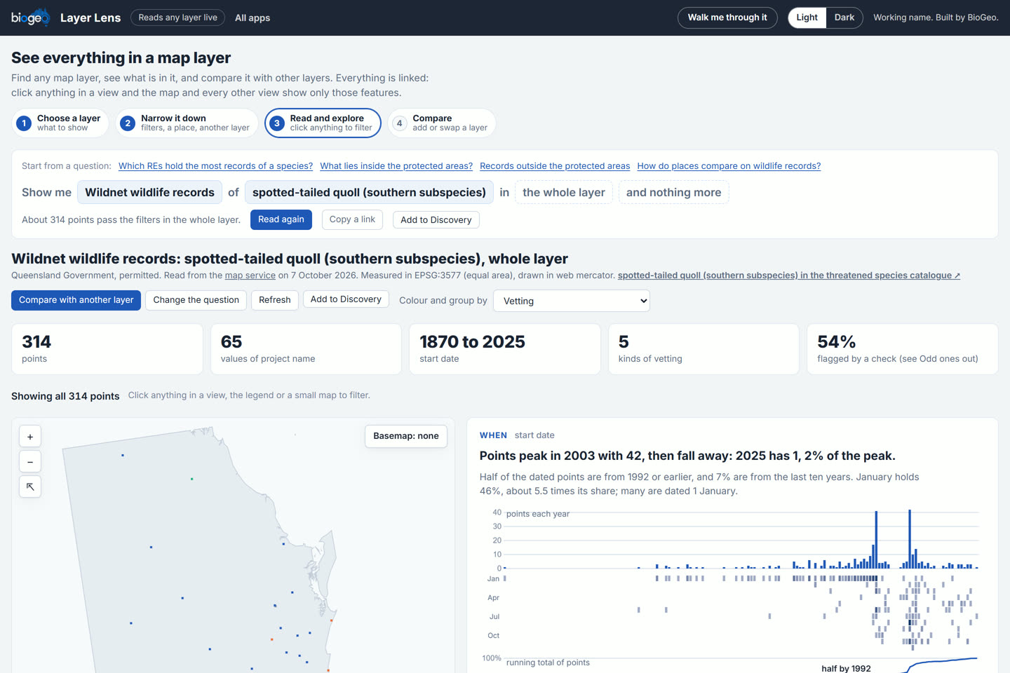
Choose a map layer, narrow it down by a filter, a place or another layer, and read what it holds: how many, where, when, and which features look odd. Every view is linked, so a click in one filters the map and the rest.

In this view, Wildnet records of the spotted-tailed quoll (southern subspecies), across the whole layer. In development. It will be listed here when it opens.

Layer Lens reading Wildnet records of the spotted-tailed quoll: counts, a map of the points and the records by year and month

Habitat quality scoring for Queensland offsets

SiteCensus Offsets

New

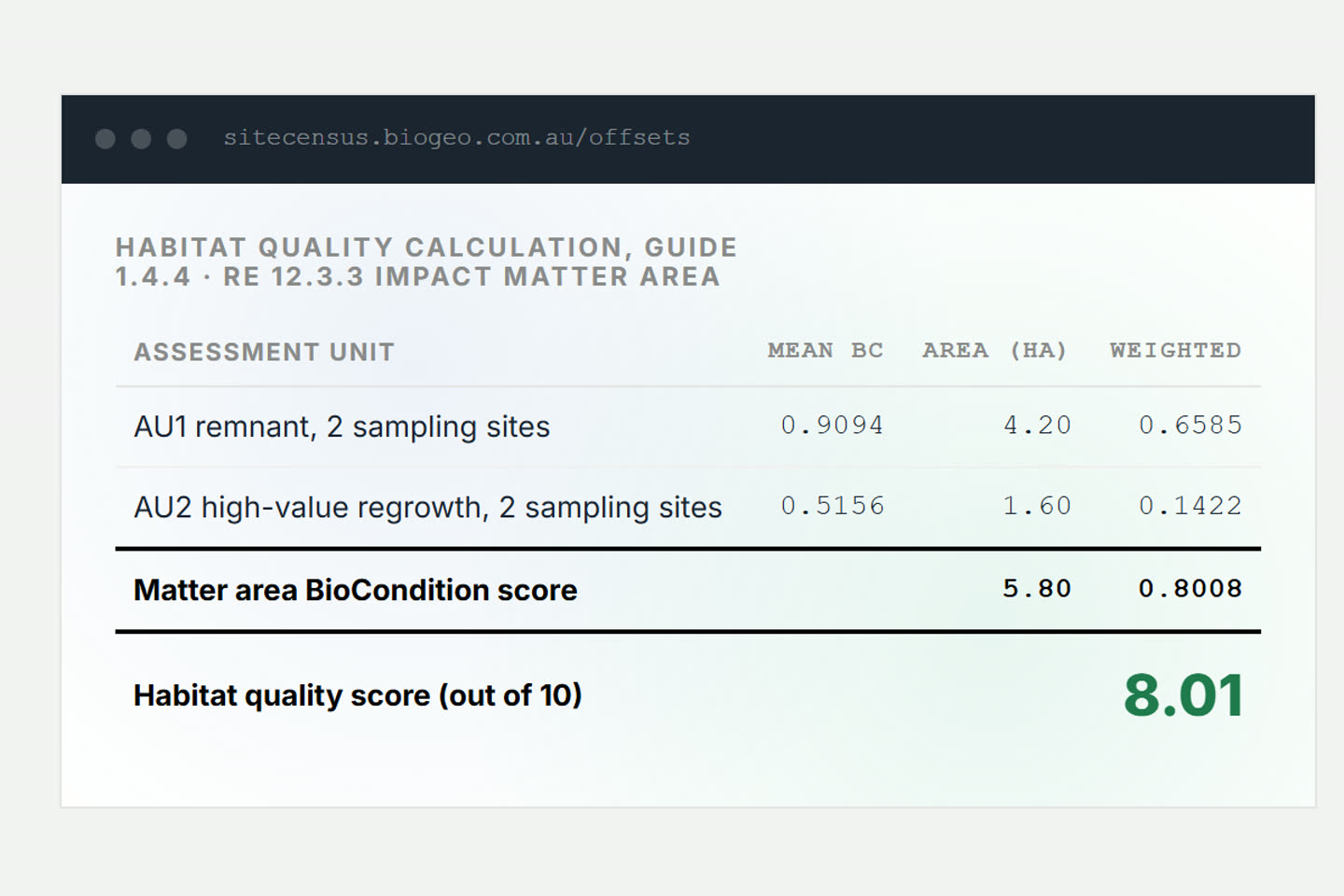
BioCondition field data in, habitat quality scores and the Offset Delivery Plan tables out. It scores by the Queensland Guide v1.3 and the BioCondition Manual against every published Herbarium benchmark.

A separate licence, with one plot scored free on its page.

For ecologists delivering Queensland offsets.

SiteCensus Offsets: a habitat quality calculation for an impact matter area

Wildlife corridors in 3D

Scenic Rim corridor map

Public

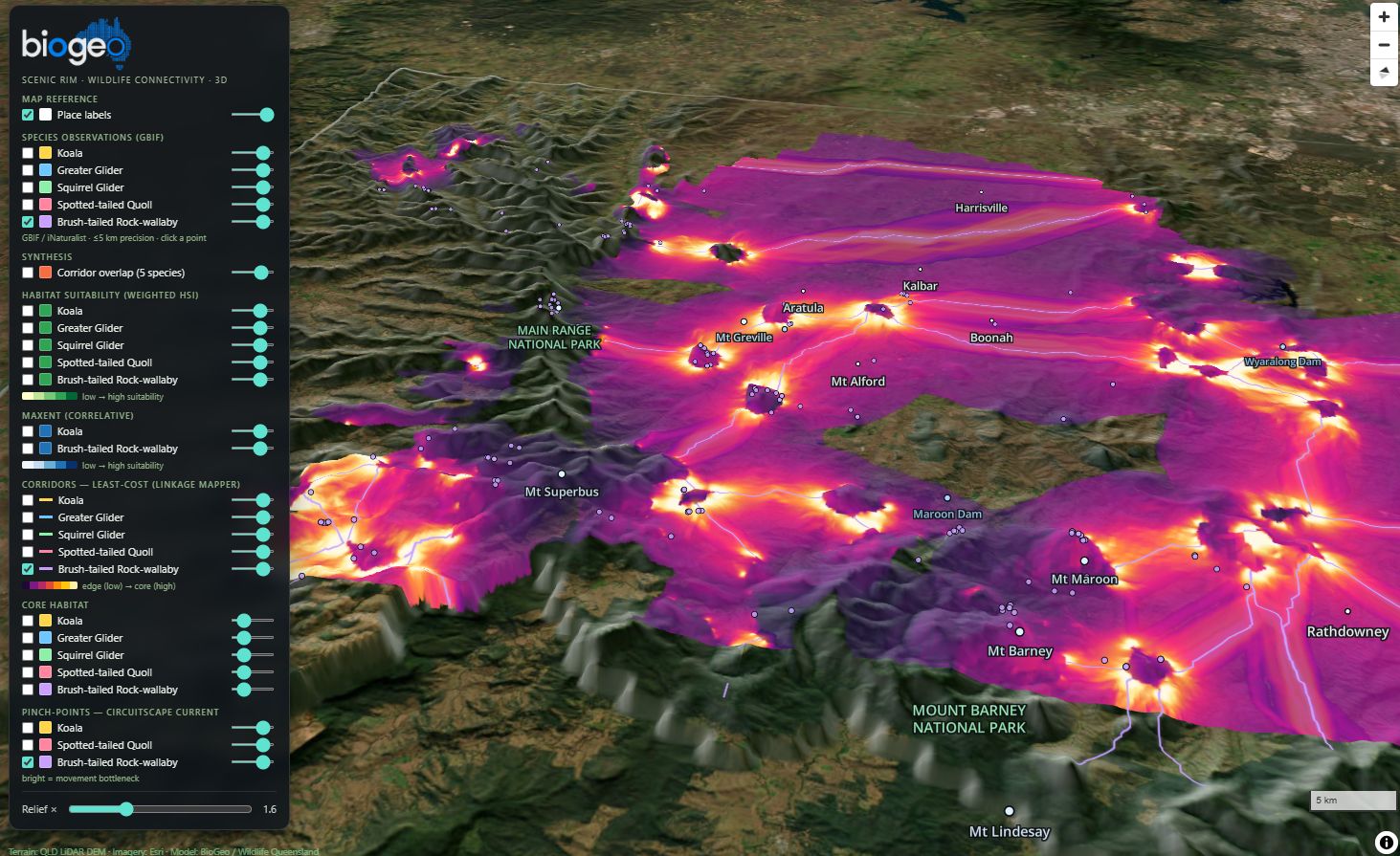
Least-cost corridors for six species across the Scenic Rim, draped over the terrain in a 3D web map anyone can open.

It came out of the corridor modelling for the Scenic Rim, described on the conservation page.

For councils, landholders and conservation groups deciding where to connect habitat.

The Scenic Rim wildlife corridors draped over the terrain in 3D

Built for the Wildlife Preservation Society of Queensland

Long-nosed Potoroo Survey Planner

Client tool

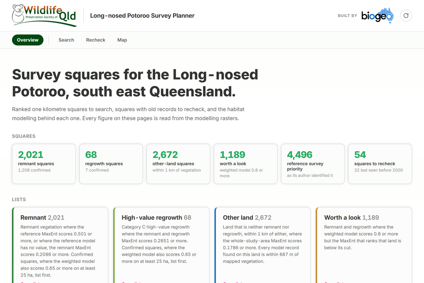
Ranked one-kilometre squares to search, squares with old records to recheck, and the habitat modelling behind each one, for south east Queensland. Every figure on its pages is read from the modelling rasters.

For the society's survey volunteers and coordinators.

The Long-nosed Potoroo Survey Planner overview: the survey squares counted, and the lists to work from

Cairns northern beaches to Port Douglas

Stinger outlook

Free

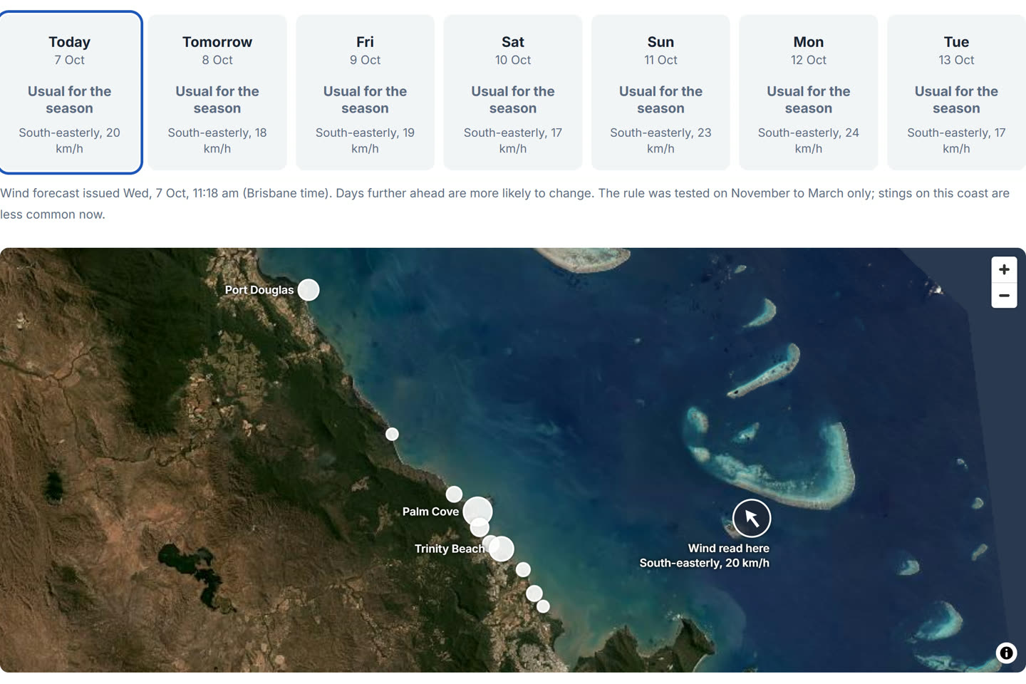
Days with a higher than usual chance of Irukandji stings, read from the wind forecast, seven days ahead. The rule behind it was tested against the stings recorded on these beaches from 1998 to 2016.

It never says a beach is safe.

For anyone on that coast in the stinger season.

The stinger outlook: seven days of cards above a map of the Cairns northern beaches

Private platforms

Several more run privately for clients, behind a password: dashboards and decision-support platforms built around one project's data. That work is described under geospatial platforms.

Have a project in mind?

Most projects start with a short call or email to set scope, timing and fit. There's no minimum project size, from a focused model over a few weeks to multi-year platform builds.